Google Maps Downloader is a minimalistic yet potent tool that can download Google Maps images based on numerous settings, allowing you to combine and shape your images the way you want. It really is a reliable and handy program.
What is Google Maps Downloader?
Google Maps Downloader is a program designed to download any Google Maps images. It offers plenty of useful capture parameters to better fits your needs, provides high-resolution images, and allows you to handle everything in a simple and clean interface.
What are the key features of Google Maps Downloader?
- Interface: It provides a simple but powerful interface to tune all the available parameters and launch downloads in seconds. You will quickly get used to handling all the different settings and fine-tuning your captures.

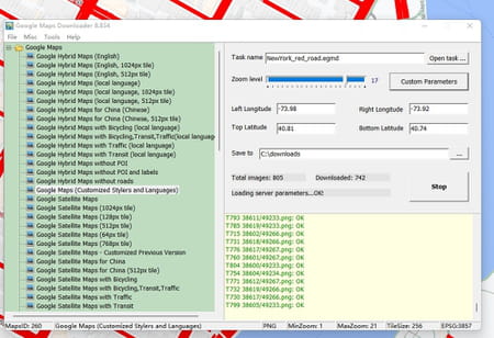
- Capture: You can capture any image from Google Maps based on many parameters to define the level of detail you want, including the map type (Google Hybrid Maps, Google Maps, Google Satellite Maps, etc.), the longitude, latitude, and zoom level. Also, it will download all the image components, including normal maps, satellite maps, hybrid maps, customized stylers maps, and more. As a result, you can download anything you want and make maps of cities and places yourself.
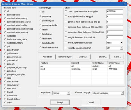
- Customize: There are tons of additional settings you can define to precisely capture what you want, including the Feature type (administrative country, administrative province, landscape, point of interest, attraction as a point of interest, road, transit, water, etc.), the Element type (if you want to capture the geometry or the labels of the selected Feature type), and the Styler to configure the colorimetric settings of the Feature type.

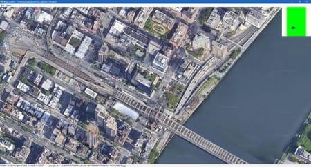
- View: You can view all the images you downloaded using the Maps Viewer tool, even when offline. Of course, you will be able to consult all the parts of the pictures you downloaded, including the satellite map, the street map, etc.
- Combine and export: Once downloaded, you can use the Map Combiner to combine batches of small images and create a gigantic one. Also, you will be able to create several output images in several formats, including BMP, TIFF, JPEG, PNG, ECW, SGI, HFA, KMZ, RST and PNM.
- Easy schedule: You can start, pause, and resume any download task whenever you want, like stopping the current one, loading a more urgent task, and scheduling your downloads the way you want.

How to use Google Maps Downloader?
- Once Google Maps Downloader is launched, select the map type on the left tree view.
- On the right panel, enter a task name (whatever name you want).
- Go to Google Maps, and either right-click on a place > What's here?, or pinpoint any area you want. The latitude and longitude in decimal will appear.
- Enter the left and right longitudes and the top and bottom latitudes to define the area scope of the images you want to download. Note that the input measurement is the degree by default, but you can convert degrees in minutes and degrees in seconds to degrees by clicking on Tools > Convert.
- Choose the zoom level.
- Select a path to save your capture.
- Click on Start to start the downloading process.
- You can view the process information in the log window.
- You can also consult the official website FAQ section.
Is it free?
We offer you the trial version of this software, which has some limitations such as the zoom level being capped at 13. You can buy the full version on on the official website.
Is it safe?
Yes, no malware or data collections and leaks have been detected.


