
How to get street view on Google Earth: VR, app, iPhone


The Street View feature of Google Earth allows you to navigate through the streets of major cities. Street View combines millions of photos to offer a 360° landscape. Read on to discover how to enable the Street View on Google Earth.
How to enable Street View on Google Earth?
To access Street View, you have to download and install the Google Earth app on your PC or mobile device. Launch the app and click on a place where you’d like to enable Street View. Then, click on Pegman in the bottom right corner of the screen.
Click on your selected area and you will see two options:
- The areas colored in blue can be seen in Street View.
- The areas colored in orange allow you to see inside a building.
To move around and change your location, click and drag the screen.
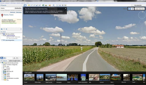
To exit the Street View mode, click on Exit Street View in the top right corner of your screen.
How to use Street View in Google Earth VR?
If you have a VR headset such as the Oculus Rift or HTC Vive a recent Google Earth update now lets you experience Street View. All you have to do while in Google Earth VR is zoom down to street level. Your controller will let you know if there is Street View available. If there is, you will be able to experience a 360-degree photo of your chosen location.