
How to view Google Maps speed cameras: 2023, iPhone, UK


Google Maps has a feature to check for speed cameras on the road in Google Maps. You can receive radar presence alerts so that you can slow down, and check where they are before planning your route. Here's how to view speed cameras on Google Maps.
In which countries can I see speed radars in the Google Maps app?
The radar query and the maximum permitted speed on Google Maps can be displayed in the following countries: Australia, USA, Canada, UK, Brazil, India, Mexico, Russia, Japan, Andorra, Bosnia and Herzegovina, Bulgaria, Croatia, Czech Republic, Estonia, France, Finland, Greece, Hungary, Iceland, Israel, Italy, Jordan, Kuwait, Latvia, Lithuania, Malta, Morocco, Namibia, Netherlands, Norway, Oman, Poland, Portugal, Qatar, Romania, Saudi Arabia, Serbia, Slovakia, South Africa, Spain, Sweden, Tunisia and Zimbabwe.
In some countries, such as Germany or France, the use of speed radar detectors is prohibited, and even fines are provided for the use of such devices. In France, the app shows speed cameras, but as the French law prohibit drivers from using them, Google advises users to disable this feature when driving in France.
Google Maps shows stationary radars as well as mobile cameras. Information about mobile cameras is reported by other users of the service, and it should be taken into account that information about mobile cameras quickly becomes outdated.
How to plan a route and avoid speed camera's with Google Maps?
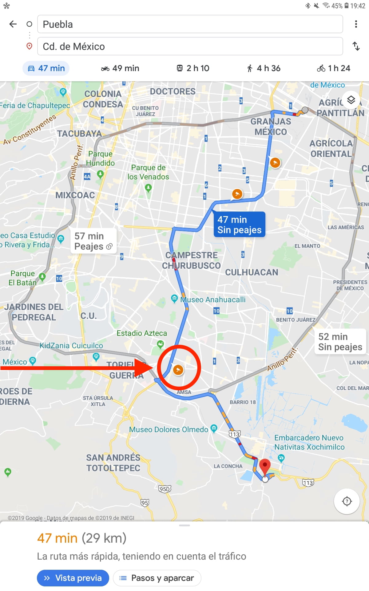
This Google Maps feature allows you to check the availability of roads with fewer speed controls or prepare for the inevitable speed cameras. This feature works on both Android and iOS versions of Google Maps. However, it is impossible to see the radars marked on the map. Launch the search bar for the desired route first to find out where they are located. In the top bar, enter your destination and activate the How to get there option. At this moment, Google Maps presents you with the options of available roads, their duration, and the radars present in each one of them. With an orange circle, the fixed radars and their locations are indicated. With an alert symbol in blue, mobile radars are informed:
How to check Google Maps speed radar information?
Although Google Maps constantly updates the system, in some cases the radar information can quickly become obsolete, especially when it comes to mobile radars. You can check the details of each radar by clicking on the icon that indicates it. A tab will open with the information and with the last moment, it was updated. So if you see that the radar has been confirmed active in the last few minutes, it most likely has remained active:,

How to receive impending speed camera alerts?
Google Maps alerts you when you are approaching speed control. Sound alerts can be disabled, but notifications on the screen will always continue to appear.